Learn Something New Every Day!

Archive for the ‘Fascinating Facts’ Category

NATIONAL AUDUBON DAY 2023: For the Love of Birds

“I realized that if I had to choose, I would rather have birds than airplanes.” Charles Lindbergh

Today is National Audubon Day, established in 1949 to help highlight the conservation and educational efforts of the National Audubon Society.

“In order to see birds, it is necessary to become part of the silence.” Robert Lynd

The National Audubon Society was founded in 1905 in the name of John James Audubon (1785-1851). Audubon is best remembered as a noted naturalist and conservationist who worked tirelessly to document the more than 700 bird species of North America.  In that process, he identified 25 new species.  His incredibly beautiful and detailed illustrations have been recorded in his book The Birds of America.  He began work on this seminal bird identification source in 1827. 

“Never give up listening to the sound of birds.”  John James Audubon

“If only the bird with the loveliest song sang, the forest would be a lonely place.”  John James Audubon

“Keep a green tree in your heart and perhaps a singing bird will come.”  Chinese Proverb

“A true conservationist is a man who knows that the world is not given by his father, but borrowed from his children.” John James Audubon

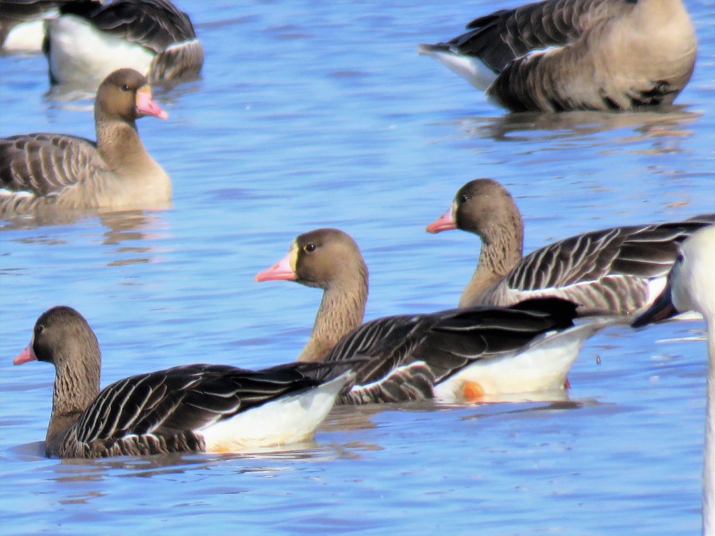
I first became aware of Audubon and his work with bird identification when I moved to Corpus Christi in 1980. A new friend introduced me to the activity of “birding,” and I have been hooked on the beauty and wonder of birds since.  I didn’t take photographs back then, but below are some of the images I have captured as I have marveled at birds over the last few years. 

“may my heart always be open to little birds who are the secret to living”  e. e. cummings

JUST DRIVING AROUND

Whenever it was raining when I was a kid—and I complained about getting wet—Dad would say, “Just run between the raindrops!”  That’s what I’ve been doing over the last several weeks as I ran errands. Running between downpours.  Still always looking for the beauty of Nature!

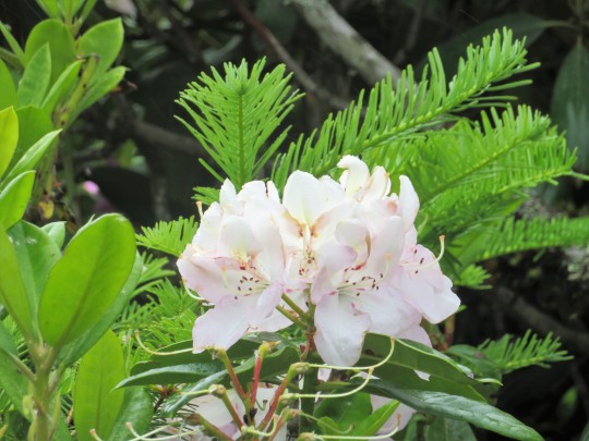
A few flowers are finally popping up around town.

Clouds are always fun to watch.

One day, a Clowder of Cats caught my eye.

This clowder of cats lives in the parking lot of a fast-food restaurant. There seemed to be about 10 of them, but only a handful ventured out to explore. There is one big cardboard box in a field behind a fence that seems to be their home base.  I am hoping someone at the restaurant is taking care of these kitties, especially during these cold wet nights. They do not seem under fed—and are so cute!

“Cats come and go without ever leaving.” Martha Curtis

“Time spent with cats is never wasted.”  Sigmund Freud

“If cats could talk, they wouldn’t.”  Nan Porter

“In ancient times cats were worshipped as gods; they have never forgotten this.” Terry Pratchet

This biggest one seems to be Mama.  She wandered by a few times, very slow and nonchalant.

This one was mostly staying behind the fence with several who never ventured out at all.

This little grey tabby was the most curious.

These two—Yin and Yang—were almost always together.

On another day, I took a Selfie, as I arrived for my tax preparation appointment. (I’m in the car!)

It was good news overall (getting back about $250, combining federal and state totals as well as tax prep fees).  I had to celebrate since Krispy Kreme was just a few blocks away. [Isn’t it against the law—or at least un-American—to not buy donuts if you drive right by a Krispy Kreme?]

The clouds that day were gorgeous, even when it rained off and on. 

When the sun did peek out, a full rainbow came into view.

“The way I see it, if you want the rainbow, you have to deal with the rain.” attributed to Dolly Parton

“Rainbows have a way of making the world seem right.” Anthony T. Hincks

A friend (thanks BLR!) has a phone with fancy editing options—so she took the ugly buildings out of this photo. 

The day ended with the rainbow anchored right over my apartment complex.

“Maybe you should stop looking for the gold and just appreciate the rainbow.” Unknown.

HAPPY SAINT PATRICK’S DAY!

The Whitney Portal Road

I love traveling Scenic U. S. Highway 395.  There are so many spots to see along the way, such as the Ancient Bristlecone Pine National Forest and Mono Lake. The road even connects with a gateway to Death Valley. (I’ve written on Death Valley’s history including Lone Pine and “The Wedding of the Waters” as well as its 2016 Wildflowers).

The other day, a good friend and I stopped overnight in Bishop, after driving the Tioga Road from Yosemite Valley.  Heading home to Bakersfield the next day, it made perfect sense to grab a deli lunch from Erick Schat’s Bakkery for a picnic at the Mt. Whitney Portal.

A Delightful Drive along the Whitney Portal Road

The Whitney Portal Road starts in Lone Pine, California, and runs 13.7 miles to the Whitney Portal Store, the staging area before hikers ascend to Mt. Whitney (14,505 feet).  The road to the trailhead was completed in 1936.  The Portal sits at 8,374 feet, a bit more than halfway way to the summit’s elevation.

As the drive begins, Mt. Whitney looms in the distance on a fairly straight, level stretch of road through the Alabama Hills.

Although not officially part of the Sierra Nevada, the Alabama Hills are part of the same geological formation and time frame as the majestic mountain range. The Alabama Hills were just shaped by different erosion patterns, giving them their rounded contours and boulders vs. the sharp ridges and jagged granite of the mountains.

The Alabama Hills are composed of two basic types of rocks.  The orange, rather drab weathered rock is metamorphosed volcanic rock from about 150-200 million years ago.  The other rock, biotite monzogranite, is from 82-85 million years ago; this rock type underwent spheroidal weathering and produced the potato-shaped large boulders strewn about the area.  This impressive public area was appropriately designated a national scenic area in March 2019.

This nice little brook was a pleasant surprise.

And I always like the breezes that make the grasses dance.

I’m not sure when this friendly mascot appeared on the scene, but he’s been welcoming visitors along the drive up toward Mt. Whitney for years.  I call him Cyril.

About half-way to the Mount Whitney Portal, the road starts to ascend into the Sierra Nevada. Its twists, turns and switchbacks follow a steep 9% grade for about 5 miles. The drive itself was prominent in two older films: Lucille Ball’s The Long, Long Trailer (1954) and Humphrey Bogart’s High Sierra (1941).

A Fun Video:  Here is an excerpt from Lucy and Desi’s drive up the mountain!

The parking for the Portal Store is not very extensive, but the area is pretty.

Eventually, we found a place for our picnic before heading back down the mountain.

The views back down into Owens Valley and the Alabama Hills are spectacular.

I love this drive from Lone Pine, California, to the Mount Whitney Portal.

If you have not yet visited the Alabama Hills, add the drive to your to-do list.  You may even discover it looks familiar, since it has been used many times in television and movie productions, such as The Lone Ranger and Bonanza and Gunga Din and How the West Was Won.

A Little Trivia:  I lived in Alabama for a year and loved the red soil that I saw in the fields where I walked my dog.  I figured the Alabama Hills must’ve somehow been named for a similar soil makeup, given their color. But no.  The Alabama Hills were named after the CSS Alabama, a Confederate warship deployed during the American Civil War.  Many of the prospectors in the area were sympathetic to the Confederacy, so when news of the warship’s exploits made its way out to California, lots of mining claims were named after the ship.  Eventually, the whole range took on the name Alabama Hills.

Spring on the Carrizo Plain 2019

A couple weeks ago, I headed to the Carrizo Plain, not quite making it to the Carrizo Plain National Monument.  The drive was gorgeous with gold splashed across the Temblor Range.

Even if there were no color, the Carrizo Plain is incredible to behold.  It is the largest single native grassland remaining in California.  It stretches approximately 50 miles long and up to 15 miles wide.  Viewing the open vistas of the Carrizo Plain is like looking into the past, when much of California was undisturbed grasslands.  It boggles the mind!

Today’s drive was dreary and cloudy, but still remarkable. There were some shifts and additions in the color evident in the hills. The golds were still there, but purple and magenta were also popping up demanding attention.  Alice Walker’s famous quote could really apply to all the vibrant colors that dance across the hills in the spring:  “I think it pisses God off if you walk by the color purple in a field somewhere and don’t notice it.”

Some California Poppies

Fiddleneck

Phacelia

Goldfields

The intersection of Highway 58 and Seven Mile Road still offered a great display of yellow splashed across the Temblor Range.  This is where this year’s first drive ended.

On this second drive, I continued on Highway 58, heading toward Soda Lake Road and the Carrizo Plain National Monument.  It was a dreary overcast day with heavy cloud cover.  But the roads were still fun to drive, the vistas were magnificent, and the flowers demanded attention.

Owl Clover

A Refreshing Breeze Was a Constant Companion

Milk Vetch

Owl Clover

Munz’s Tidytips

What eventually became the National Monument started in 1988 when 82,000 acres of the Carrizo Plain were purchased in order to preserve the grassland.  In 1996, the area was officially labeled the Carrizo Plain National Area.  Then, in 2001, President Bill Clinton officially made the area a National Monument.  By that time, the preserved lands had increased to almost 250,000 acres.


Baby Blue Eyes

This is a distant view of the Temblor Range from the far end of Seven Mile Road where it intersects with Soda Lake Road.

Aerial View of Soda Lake
Google Image

A major feature of the Carrizo Plain is Soda Lake, which is located on the southwest side of the Plain’s northern section. The lake—when full—covers an area of 4.6 square miles. It sits at 1,900 feet and is comprised of two large basins and 130 smaller pans.  Officially, Soda Lake is “a shallow ephemeral alkali endorheic lake.”  Basically, it is one of the largest alkali wetlands in natural condition left in California.  When the water from a wet winter recedes, a salty crust is left on the surface. Soda Lake Road, itself, parallels the lake and stretches from Highway 58 in the north to Highway 166 in the south, covering at least 25 miles. You can hike out toward the lake, if you are so inclined.  I am impressed enough just driving along it for miles and miles.

Below is a distant view of Soda Lake from the intersection of Highway 58 and Seven Mile Road.

Soda Lake Road is an intense drive: some sections are paved, but most of it is hard-packed dirt covered by ruts and potholes and even some washboard sections. Drive carefully but enjoy the scenery!

I saw and heard several meadowlarks, but they refused to be photographed.  This sparrow did cooperate for a few photos.

As I headed home, it began to rain. Refreshing end to a nice day!

If you have never visited the Carrizo Plain, add it to your bucket list.  There is still some time this year when the color should stay vibrant.  Or put a visit on your calendar for next spring.  Of course, any time of the year you can hike and appreciate the open grasslands, including seeing some painted rocks left years ago by indigenous tribes or wandering literally on a section of the Andreas Fault. It’s an incredible place.

This is a helpful article about traveling to the area. Johna Hurl, Manager of the Carrizo Plain National Monument, does not use the term superbloom. Instead, she simply says, “It’s springtime in Carrizo.”

NOTE:  I have identified the names of wildflowers when possible.  I am not 100% certain all my labels are correct.  There are several that I would just call “pretty flowers.”  If you can share some names or corrections, please do so.

Ah, ASPENS!

“Go spend time with the aspen trees.  They’ll tell you how it works.  They’ll tell you to look to your roots for energy.  They’ll tell you there’s warmth below the surface.”   Kaya McLaren

Aspens have always fascinated me.  I love the yellow leaves in the fall, especially when they blow in the wind.  But the black and white trunks fascinate me as well—they somehow exude strength and dignity.  But the truth about aspens is even more remarkable than how gorgeous they are.

Each individual tree is actually part of a greater whole, a larger organism called a cluster or clone.  All the trees in a grove share the same root system.  Even if all the visible trees are damaged or cut down, the root system lives on, sending more trees up into the world.  In fact, each tree is really an identical replicant of all the other trees on the stand. If any specific tree needs a bit more help than the others—like more water or nutrients—the root system helps make that happen.   Talk about one big family!

The world’s oldest living aspen clone is in Utah, and it has lived more than 80,000 years.  That’s older than Sequoias and Ancient Bristlecone Pines.

ASPENS ARE TRULY REMARKABLE!

I loved watching the leaves dance when a gentle breeze blew through.


The photos in this blog were taken on my recent drive along Highway 120 over the Tioga Pass and along the June Lake Loop off Highway 395.  To learn more details about aspens, visit these two blogs:  Life is an Aspen Tree and Aspen: So Much More Than a Tree.

Memories of Summer: Tioga Pass Road (August 2017)

Super Bloom 2017 was truly magnificent!  I took several little trips around California that spring, enjoying the wondrous blooms that seemed to be almost everywhere:  Carrizo Plain, Anza Borrego Desert State Park, and California Poppy Preserve were some of my favorite stops. I visited Yosemite National Park in June, hoping to see some wildflowers there as well.  My first stop was Yosemite Valley.

For the rest of that Yosemite trip, I had planned to drive across Tioga Pass Road to see what might be in bloom.  The road closes for winter every year, usually opening again by late May, so I did not foresee travel problems.  In 2017, however, the road did not open until the end of June.  Thus, my plan for driving over the pass had to wait.

I tried again in August on a beautiful sunny day, and the drive was wonderful.  The route started near the Big Crane Flat Road, taking Highway 120 east, traveling about 90 miles from Yosemite Valley to the Eastern Entrance to Yosemite. The initial easy ascent into the mountains showcased some great wildflowers.

As the elevation increased, the flowers gave way to trees, rocky hillsides, and eventually open vistas.

Olmstead Point is always a great place to stop and park.  There are even some short hikes that start from this parking area.  The views are incredible. I especially liked the big boulders that seem to be randomly scattered across the hills like marbles, awaiting for someone to come back and play.

Moving further east, Lake Tenaya came up alongside the road.  It is the largest natural lake in Yosemite National Park that is so close to a roadside.  If you take the time to stop and explore, there are some hikes in the area as well.


Highway 120 finally travels past Toulumne Meadows, my favorite part of the drive.  This sub-alpine meadow sits 8,755 feet high.  Although flowers were not extensive, the meadows were beautiful and expansive.


At various stops along the meadow, I took some videos to capture the panoramic sense of the meadows.

Moving beyond Tuolumne Meadows, the route finally reached Tioga Pass, at an elevation of 9.943 feet. Then it was a steep decline the six miles to the Eastern Entrance. The road passed Tioga Lake before connecting with Highway 395.


ANY DAY ANYWHERE IN YOSEMITE IS A GOOD DAY!


ACOMA PUEBLO: A Little History & A Tour

A LITTLE HISTORY

Currently, there are 19 Pueblos in New Mexico that trace their ancestry directly back to the Ancestral Puebloans:  Acoma, Cochiti, Isleta, Laguna, Nambe, Ohkay Owingeh, Picuris, Pojaque, Sandia, San Fellipe, San Ildefonso, Santa Ana, Santa Clara, Santo Domingo, Taos, Zia, and Zuni.  (Hopi are also ancestors of the Ancestral Puebloans, but their Pueblo and reservation are in Arizona.)  Some of the New Mexico tribe names are better known than others; some stand out for their unique art whether as jewelry, baskets or pottery. Acoma and Taos are probably the two most well-known pueblos in New Mexico and throughout the world.

Tourism is an important industry for both Pueblos, and they welcome the opportunity to educate others about their history and culture.  Years ago, I visited both Acoma and Taos Pueblos on different trips. My visits confirmed what I have always valued about native cultures.  Their sense of community. Their connection to and appreciation of Nature.  Their historical feats of engineering and astronomy.  Their artistry demonstrated through their jewelry, pottery and other artifacts. But especially their perseverance.  Both Acoma and Taos Pueblos have been continuously inhabited since about the year 1000.  And their ancestors have been in the area since before Christ.  Their art, culture, religion, and language all continue on.   Remarkable.

ACOMA PUEBLO

Driving to Acoma Pueblo–also called Sky City–as It Sits Atop Its Plateau

Acoma Pueblo is the most southwestern of the pueblos, sitting about 60 miles west of Albuquerque. It is also one of the remaining pueblos that has been continuously populated since at least the year 1200.  It sits atop a plateau that is roughly 360 feet high.  The word Acoma means “the place that always was.”  In 1540, Alvarado, an explorer working with Coronado, offered this description of this stronghold sitting high atop a plateau:

Acoma is “the greatest stronghold ever seen in the world. The natives. . . came down to meet us peacefully, although they might have spared themselves the trouble and remained on their rock, for we would not have been able to disturb them in the least. . . . The city was built on a high rock.  The ascent was so difficult that we repented climbing to the top.  The houses are three and four stories high.  The people. . . have abundant supplies of maize, beans and turkeys like those of New Spain.” 

Although visited by the Spanish in the 1540s, Acoma was not invaded until several months after the arrival of Juan de Onate y Salazar in 1595.  When Onate’s men demanded food from the Acomas, food that was needed for the tribe to survive the winter, a skirmish took place.  Eleven Spaniards were killed, including Onate’s nephew.  In retaliation, the village and its provisions were burned, 600 people were killed, and another 500 men, women and children were taken as prisoners and sentenced to servitude.  Each warrior under the age of 25 had his right foot amputated.  These atrocities are some of the war crimes that Onate was eventually charged with when he was recalled to Mexico years later.

Google Image

In 1998, a statue of Onate was erected, paying tribute to him as the founder of New Mexico. He served as the area’s first governor from 1598 to 1608. Not surprisingly, many Puebloans protested the action.  Part of the protest was conducted one night: Someone used a chainsaw to cut the right foot off the bronze statue.  Seems a fitting action to me!

Although the lands held by the Acoma Pueblo originally totaled nearly 5,000,000 acres, Acoma today retains control over less than 10% of that original total.  The 2010 census says 4,989 native people live in the immediate area surrounding Acoma.  About 30 of the tribe members still live in the actual dwellings on top of the plateau without electricity, running water, and sewage.  In 1960, Acoma Pueblo was named a National Historic Landmark, and in 1966 it was placed in the National Registry of Historic Places.

VIEWS OF THE PUEBLO AND AREA

Mount Taylor

Enchanted Mesa from a Distance–about 2.5 Miles from Acoma

Tradition Says the Acoma Tribe Lived on Enchanted Mesa Until Storms Blocked Access

Stegosaurus Rock


Currently, Acoma allows tourists to visit the pueblo on guided tours.  A main attraction is its church called the San Esteban Del Rey Mission.  It is the largest southwest mission, and its construction was started in 1629 with the arrival of Father Juan Ramirez.  Natives were conscripted into building the massive structure, carrying logs 40 miles from Mount Taylor for use atop the plateau.  All sand needed for the construction also had to be carried to the top of the plateau.  The Acoma Pueblo participated in the Pueblo Revolt in 1680.

San Esteban Del Rey Mission

Despite the slave labor and harsh conditions, Acoma Pueblo today attaches cultural significance to its mission. After all, their ancestors built by hand a structure that has stood for nearly 390 years.  A group of men called the Gaugashti or “church caregivers” take on the responsibility of maintaining not only the structure but the culture associated with the mission.

Tour Guide

Tourists are able to take a tour through the village, seeing some of the original buildings and pathways. The tours also let you chat with some tribe members and hear about their history and culture.  On my visit to Acoma decades ago, the tour guide was a young woman, who was informative and friendly.

Some of the Original Buildings

Original Ovens, Some Still in Use

Street in the Pueblo

Pathway from the Pueblo

Postcard of Women Getting Water along the Pathway, 1920

Google Image Traditional Pottery

Another Traditional Pot Google Image

Acoma tribe members have always been noted as great pottery makers. The traditional pots are impressive.  Of course, on my visit, I bought a little pot—being a little smaller than a baseball, it fit easily in my hand.  But the intricate detailed design is what captivated me.  I loved chatting with Charlie—the artist—about the creative process.

My Delightful Little Acoma Pot Made by Charlie

If you have not visited the Acoma Pueblo—or any of the other pueblos open to the public—add such a visit to your list.  It is well worth the visit!

Roadside Treasures

In June, a friend and I drove from Bakersfield, California to Portland, Oregon.  We had a great time and saw some beautiful scenery.  Even when we were not visiting somewhere specific such as Crater Lake or the Mt. Hood Scenic Byway, natural beauty was all around.  That’s one of the main reasons I love to drive when on vacation—there is always something wonderful to see along side the road or at various hotels and shopping centers.

You just need to keep your eyes open for nature’s treasures.

IMG_7166

Clouds are always wondrous!

Of course, not all that we saw was captured on film.  Along the road, we saw egrets, red-winged blackbirds and several hawks.  Flowers danced along the major highways, even when we could not easily stop to take a photo.  There were even some sunflower fields and the beginnings of rice fields along the way.  Of course, there were also treasures we knew where there but were hidden by clouds.  Mt Hood in Oregon eluded our cameras as did Mt. Shasta in California.  This photo of Mt. Shasta is from years ago, but it emphasizes what a wondrous, substantial peak can be easily hidden by clouds.

The best unexpected treasure on this trip was Priscilla, the Dragon Queen of the Sierras.  I’ve written in more detail about Ralph Starritt, the incredible artist who created the life-size dragon.

Crater Lake 2018

Crater Lake National Park was created in 1902 by President Theodore Roosevelt.  It is the fifth oldest park on the country and the only one in Oregon.  The lake itself, deepest in the United States and ninth deepest in the world, is the center piece of this 183,224 acre park. The lake’s depth was first recorded in 1886 as being 1,996 feet deep.  The reading was taken through use of a simple wooden sounding device that lowered a section of pipe attached to a piano wire.  More recently—with fancy scientific equipment—the depth was recorded as 1,943 feet.

Crater Lake is an incredible geological feature.  Its creation about 7,700 years ago was witnessed by the tribes that lived in the area.  When Mt. Mazama erupted back then, the peak collapsed on itself and left the caldera that eventually became Crater Laker. There are no rivers or streams or even underground springs that feed the caldera.  Instead, it took centuries for the lake to fill with snow and rain—and it has stayed filled with nearly pure water ever since.  Today, it contains 4.6 trillion gallons.

The water’s purity is what gives Crater Lake its incredible blue color.  The water is so pure that when the sunlight hits it, all colors of the spectrum are absorbed except blue which bounces back to the observer.  On cloudy days, especially when smoke and haze clutter up the air, the color is less than spectacular, as I saw when I visited last year.

My trip this year was spectacular.  A friend and I drove the 33-mile Rim Drive, stopping to enjoy the views at various look-outs both to the lake and away from it.  Medford, where we started that morning, was predicted to be sunny and in the 70s.  Throughout the day, the skies grew a bit cloudy and the weather turned a bit gray and cold.  For a short time, there was even some hail and snow!  The wildflowers were incredible, especially since one of the rangers explained that the blooms rarely lasted more than a week.

Views along the Road


Looking away from the Lake

Views of the Lake

Some Trees & A Bit of Snow


At one point, a bit of a drizzle turned into some hail!

A little later, some snow flurries erupted as well, for just a few minutes.


The Lovely Wildflowers


It was a beautiful day!

* * * * * * * * * * * * * * * * * * * *

In 1903, Joaquin Miller (1837-1913) was a part of the Steele Excursion that was exploring the new national park. Although more popular in England, he wrote enough about the area to be called “Poet of the Sierras.”  Sunset magazine commissioned him to write about his observations and experiences at Crater Lake.  In an article titled “Sea of Silence,” Miller offered this description:

“The lake? The Sea of Silence? . . . fancy a sea of sapphire set around by a compact circle of the great grizzly rock of Yosemite. . . , It lies two thousand feet under your feet, and as it reflects its walls so perfectly that you cannot tell the wall from the reflection of the intensely blue water, you have a continuous and unbroken circular wall of twenty-four miles to contemplate at a glance, all of which lies two thousand feet, and seems to lie four thousand feet, below! Yet so bright, yet so intensely blue is the lake that it seems at times, from some points of view, to lift right in your face.” 


NATIONAL PARKS: BEST GIFT EVER!

Yellowstone National Park was the first national park, initially established in 1872.

Yellowstone National Park was the first national park, initially established in 1872.

logo jpgToday is the 100th birthday for the National Park Service.  It was President Woodrow Wilson who signed the mandate creating the agency on 25 August 1916.  Since then, its charge has remained the same: protect designated land for its beauty and wildlife as well as its historical significance for the enjoyment of future generations.  That goal expanded to include assuring public access to these protected areas.

That assurance of public access is what makes the National Parks the best gift ever.  Not only can visitors enter the areas, but they will find visitor centers, knowledgeable rangers and volunteers, established paths and scenic drives as well as parking and bathroom facilities.  Not all locations are 100% accessible, but most are upgrading their facilities and have at least some hiking options accessible for wheelchairs.  The access is not free, but the entrance fee is minimal, typically $30 for a car to have access for a week.* Annual and lifelong passes are options as well.

Grand Canyon

Grand Canyon

Book heacoxWhen you unwrap this gift, you will find a wide variety of places to visit and enjoy.  To see the magnitude of what the national parks oversee, I went to National Geographic’s The National Parks: An Illustrated History (May 2015).  Through photos and essays, the book explains how the National Park Service “represents freedom, adventure, diversity, dedication, respect, and restraint.”  Here is the book’s opening overview, by the numbers:

84,000,000 acres of land

75,000 archaeological sites

18,000 miles of trails

247 endangered plants and animals

407 park properties including

78 national monuments

59 national parks

25 battlefields

10 seashores

27,000 historic and prehistoric structures

20,000 employees

246,000 volunteers

292,800,082 recreational visits in 2014

Yosemite Falls

Yosemite Falls

Not everyone is a fan of the national parks, however.  Some visitors even offer some less than stellar Yelp reviews.  According to a few of these reviews, the parks are too crowded, which can happen in the height of the season. The potential of too many other visitors is why I try to visit places in early spring, before summer crowds start showing up.  Other complaints, of course, are just downright silly and say more about the complainer than the national park in question:  too lonely, too expensive, lack of cell service, poor food, no adequate showers, not seeing enough wildlife, but also seeing rattlesnakes OMG.

More specifically, someone felt Yellowstone National Park smelled too much like sulfur, which—of course—is a bi-product of the thermal features that make the place unique.  And one person advises to be careful when visiting that big hole in the ground, the Grand Canyon, because it is a long fall to the bottom: “Do not hover about the Canyon whilst drunk.  You will fall over the edge and you will die.”  I think my favorite comment was posted about South Dakota’s Badlands National Park:  “Waste of time.  Thank god I was drunk in the backseat for the majority of the trip.” 

Yellowstone National Park

Yellowstone National Park

YSNP bison sitting

YSNP bison scratch

IMG_2769I have had the good fortune of visiting many but not enough national parks as I wander on my nature treks, typically in the spring each year.  My most recent visits were to Yellowstone National Park, where I was able to see bison up close and personal, and Saguaro National Park, where I finally saw saguaro cacti in bloom. The Great Smoky Mountains National Park is the most visited national park in the nation, with nearly 10.1 million recreational visits in 2014.   The Golden Gate National Recreation Area was the most visited property with 15 million visitors in 2014.  Utah offers many parks from which to choose, including Bryce Canyon, Canyonlands, and Zion National Parks.

Saguaro National Park

Saguaro National Park

GC deer close

Winter at the Grand Canyon

Winter at the Grand Canyon

Two of my favorite destinations are Yosemite National Park and the Grand Canyon.  They feel the same to me in their majestic and beautiful vistas that encourage quiet contemplation and spiritual connections.  But they are different in mood, I suppose.  The grays and blues of Yosemite are cool and calm, punctuated by the power of waterfalls.  The red and brown hues of the Grand Canyon are warm and soothing, inviting one to sit and enjoy the view of the often muddy Colorado River far below. If you sit quietly at either location, you are apt to see some wildlife as well.

Spring at Yosemite

Spring at Yosemite

Squirrel Enjoying the View

Squirrel Enjoying the View

Running Off with Lots of Nuts! Grand Canyon

Running Off with Lots of Nuts! Grand Canyon

Yosemite Cloud's Rest, Hazy Day

Yosemite Cloud’s Rest, Hazy Day

Yosemite Falls

Upper Yosemite Falls

Book shiveWhen you visit, wherever you visit, I am certain you will be delighted.  There are three great books that provide magnificent photos and details about the national parks and monuments.  The books themselves became my souvenirs this year to mark the National Parks’ 100th Birthday.

Here are the book titles—they do make great gifts:

The National Parks: An American Legacy (2105) with photographs by Ian Shive.

The National Parks: America’s Best Idea An Illustrated History (2009) by Dayton Duncan and Ken Burns.

Book Burns

National Geographic’s The National Parks: An Illustrated History 100 Years of American Splendor (2015) by Kim Heacox (mentioned above).

Of course, it is the visit to any of the parks that is the real gift.  I encourage you to accept the present and get out there visiting a park or monument near you soon!  It will be a gift that keeps on giving!

WHAT IS YOUR FAVORITE NATIONAL PARK? 

WHAT PARK ARE YOU HOPING TO VISIT NEXT?

* * * * * * * * * * * * *

*For price comparisons:  Entry fees to Disneyland are $110 per adult per day; San Diego Zoo, $50 per adult per day, and Los Angeles Zoo, $20 per adult per day.  National Parks are certainly a great value!